Revitalization of Josip Andrić square
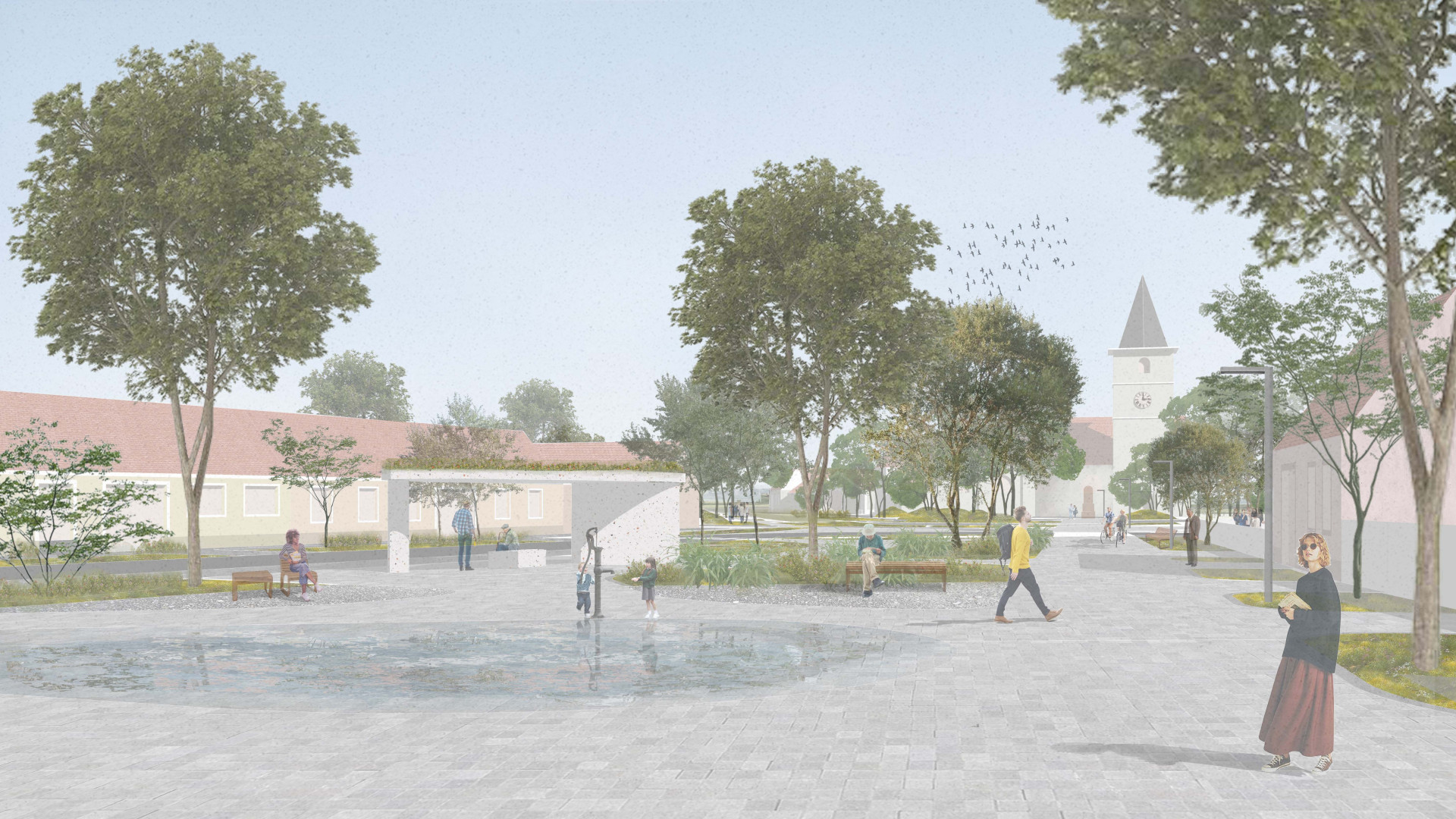
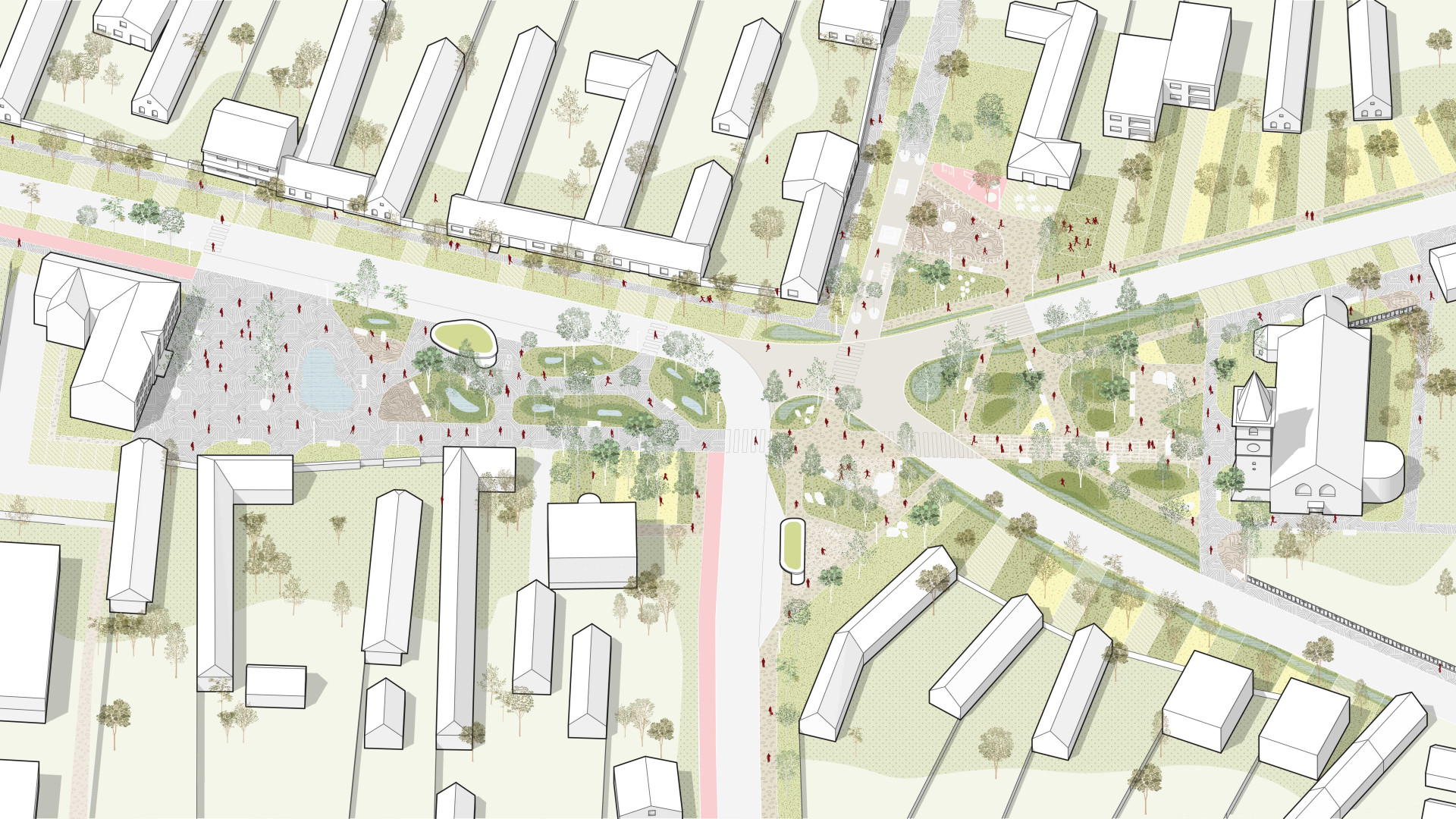
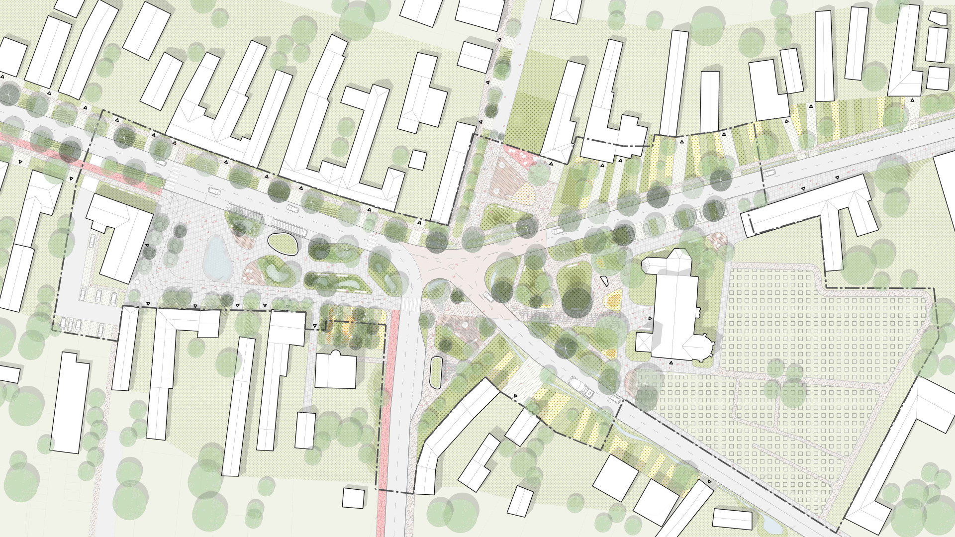
Chorvátsky GrobRural Promenade – Connecting the Islands of Chorvátsky Grob The village was established and has developed mainly around networks and movement axes. The proposed additional layer supports and extends the existing axis from the municipal office to the forecourt of Church of Christ the King. Along this axis are placed historical and commemorative elements of the village, such as the bust of Josip Andrić, the municipal coat of arms, and roadside shrines. The rural boulevard brings the public-space islands closer together and connects them, becoming not only a communication route but also an educational and social element of the village centre, while linking several additional attractive places and corners. Islands The selected form of smaller islands is based on the existing network of paths and public spaces. This loose structure contrasts with the strictly arranged built fabric and parcel division of the village, creating pleasant spaces suitable for pedestrian orientation and movement. It also represents a parallel to the “islands” of history and culture within contemporary village life, serving as a reminder of the past and of the significant contribution of Croats to shaping the identity of Chorvátsky Grob. The main idea that unites the space, alongside the rural promenade axis and the island form, is the concept of recycling and water management — in other words, solutions based on the natural and human potential already present in the site. By deepening this principle, interconnected spaces are created that function like islands, self-sufficient in both implementation and maintenance. This naturally supports and generates diverse atmospheres. Water Square The objective was to create sufficient compensatory water-retention measures in the area with the highest proportion of paved surfaces through rain gardens and surface depressions integrated into the paving. This creates the character of a water square with a pleasant microclimate, while also referring to the Croatian history of the village. In front of the municipal office, the original structure of the public space is preserved and connected to the rural promenade, greenery is expanded, and a water feature is added. Static parking is relocated to the courtyard behind the municipal building, where it connects to Športová Street and the football field. Traffic here serves as a service road for existing houses and as a shared cycle-access path. The largest paved area in a municipality of 5,000 inhabitants is designed as a dynamically changing space. The water feature takes the form of a paved depression with a water attraction represented by a hand pump. This element may either be filled with water or serve as an expanded surface for markets and other municipal events. Stone Island The space between the municipal office and the church is designed as a stone landscape, where smaller rocks and stone paving are arranged around the existing obelisk memorial. This area is complemented by a bus stop that acts as a focal point of public space and a meeting place for residents. The stop also integrates collection containers for separated and recyclable waste, contributing to sustainability and ecological awareness within the community. Forest Park The forecourt of the Church of Christ the King is redesigned by modifying part of the path network due to the removal of the fence and the potential for new connections. The new paths are linked to the existing ones and extend the rural promenade. The area in front of the church, together with its side entrance, is intended for events such as weddings, confirmations, and similar gatherings. Children’s Park This space is created by expanding the existing playground into the current parking area and road. Children on their way to and from school can spend time at the playground and have ice cream in a safe environment free from cars. The existing asphalt road is transformed into a sports playground with active recreational elements such as table tennis, climbing structures, and workout equipment. Productive Front Gardens and Green Infrastructure The front gardens of houses within the public space are proposed as productive orchards, referring to the historical and cultural tradition of cultivation in the village. Green areas along the main road are designed as water-retention systems for collecting runoff from roads and parking areas.
studio: Mooods
team: Patrik Domanický, Bohdan Hollý
scope: Competition proposal
area: 2,1 ha
client: Mesto - Chorvátsky Grob
locality: Chorvátsky Grob
Axonometry
Chorvátsky Grob has a strategic location in relation to surrounding municipalities as well as Bratislava, and these attributes create strong potential for the municipality’s development as a suburban part of the capital city. It is essential to establish an adequate and high-quality network of public spaces already now for both current and future residents, as this contributes to long-term community development, improves quality of life, and supports sustainable urban growth. Chorvátsky Grob is a traditional village that originated at a road intersection where social life, culture, and trade developed. Today, it seeks to combine historical heritage with a modern lifestyle, making it an attractive place for both present and future generations. Historically, the central part of the village was a place for public buildings such as the church, municipal offices, shops, and inns, which together formed the public space. Today, this space is used predominantly for vehicular traffic, which limits pedestrian movement. The effort to reconnect the central area involves creating interconnected islands derived from the historical spatial structure. The aim is to appropriately reduce both dynamic and static traffic so that pedestrians regain priority and can safely and actively use the public space again.
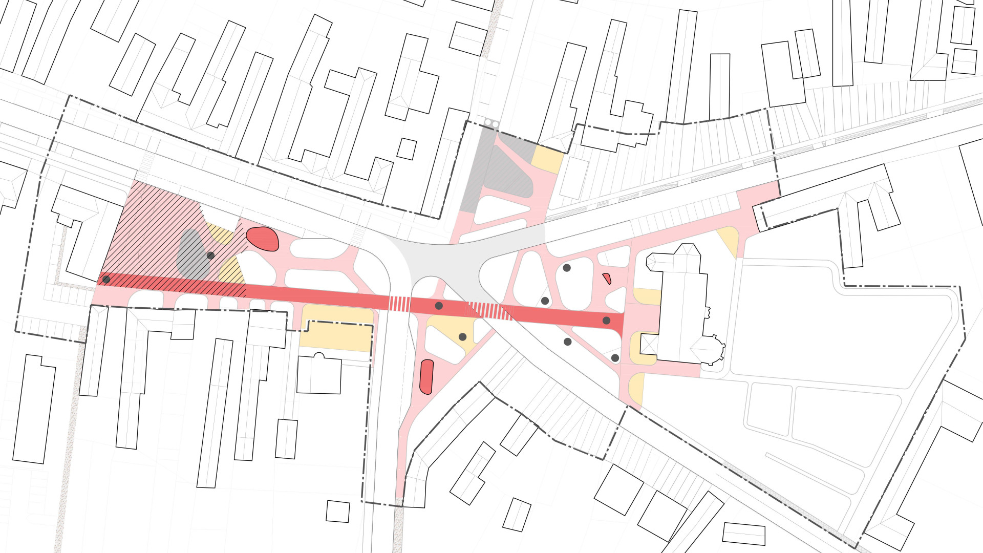
Diagram - public spaces
The public space is divided into individual islands connected by a rural promenade. Each island retains its identity while its atmosphere is further reinforced. Four landscape atmospheres are considered: water landscape, hills and forests, rocks and mountains, meadows and fields. The rural promenade forms a clear axis within the public space, linking and bringing closer places that previously did not communicate with one another. This axis itself accommodates multiple activities as well as cultural and historical elements. A significant intervention is the expansion of the children's playground by incorporating the adjacent parking area and road, transforming the space into an attractive children's park located along the route to the village subcentre of civic amenities. Bus stops are designed as integrated units incorporating waste bins, public toilets, and service facilities. Urban furniture is supplied by mmcité, while children’s play elements are provided by Richter Spielgeräte. Materiality in the central space remains concrete paving; in the secondary space characterized by mountains and rocks, stone paving is used; the area in front of the church is designed as compacted gravel with recycled fencing; and the children’s playground is composed of sand, compacted gravel, tartan surfacing, and wood.
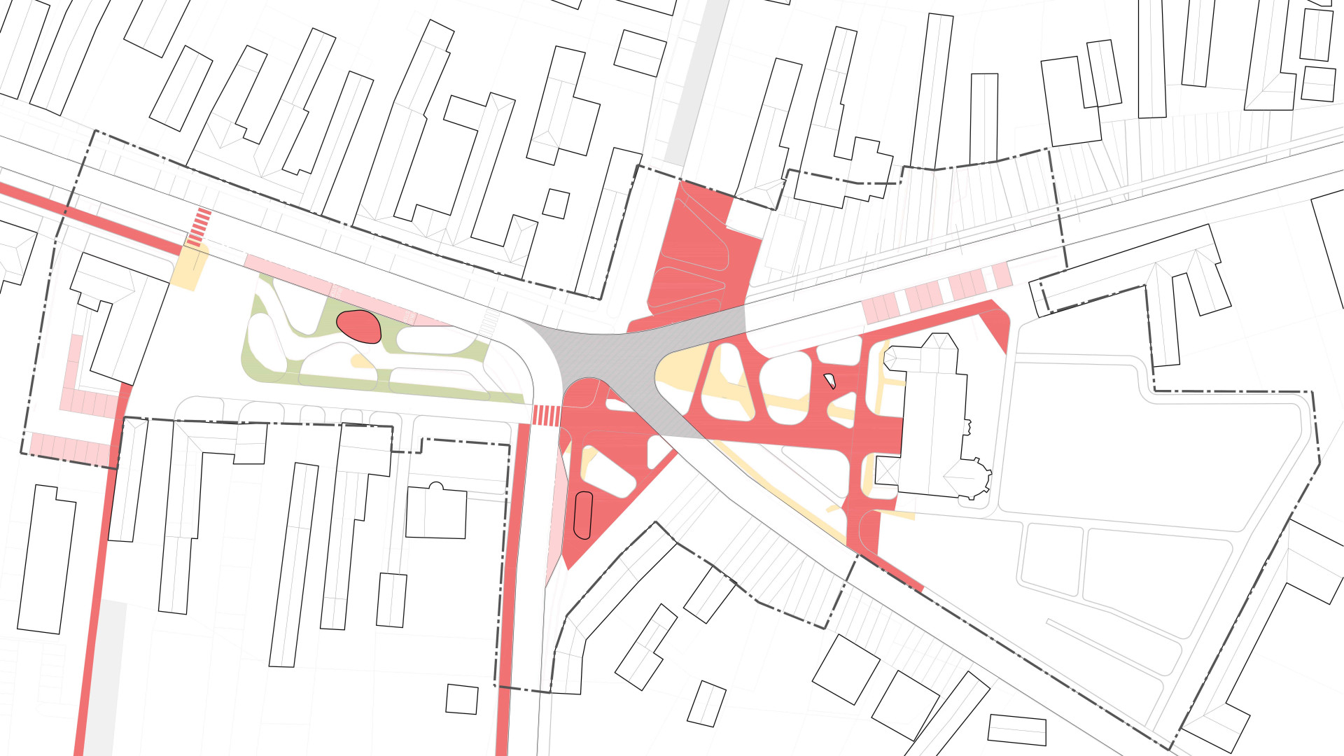
Diagram - old / new
The sustainable approach seeks to make the best possible use of the site’s natural and human potential. For this reason, a large portion of the existing ground plan of public spaces and paved surfaces is preserved and redesigned. The church fence that was removed is reused as stepping paving, while part of its foundations is repurposed as a base for creating terrain mounds within the area. The original asphalt road is transformed into a workout and sports area. The overall proposal modifies (removes and adds) 3,955 m² (20%) of the area, while the remaining surfaces stay largely unchanged without significant intervention. The reconstruction of the square does not increase the proportion of impermeable surfaces; such a system provides an economical and sustainable solution for adapting public space to climate change. Electrical lines in part of the square are relocated underground. The project is divided into three phases. The first phase is linked to relocating the bus stops and revitalising the two spaces associated with them. The second phase includes traffic changes, the closure of Mila Urbana Street as a through street, and the revitalisation of two additional spaces. The final phase consists of completing the cycling route through the village.
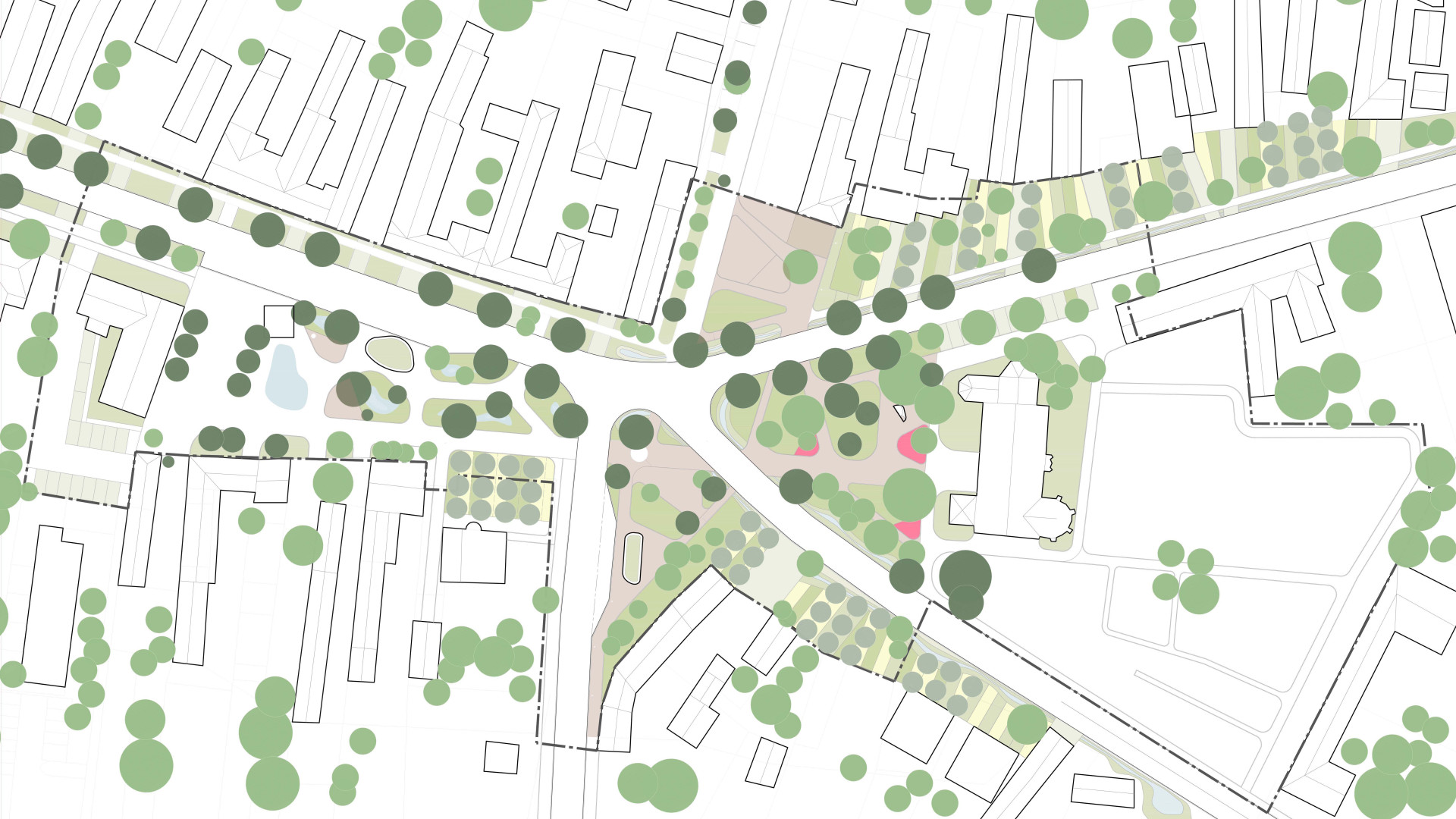
Diagram - blue-green infrastructure
The concept is based on retaining rainwater where it falls and gradually releasing it into the air or soil. The main public space, the square, is transformed into islands of rain gardens with new planting and a surface water feature, connected to a retention tank for irrigation. In the remaining spaces, water retention is addressed through suitable planting and subtle terrain modifications. In the preliminarily designed areas, the proposal includes the creation of orchards and roadside greenery that will serve to retain water from these areas. This concept is intended to serve as an example for the entire municipality. The reconstruction of the square does not increase the proportion of impermeable surfaces; such a system provides an economical and sustainable solution for adapting public space to climate change. Low-maintenance vegetation is proposed, including perennials, tall grasses, and urban trees such as plane trees and ash trees. In the forecourt of the church, existing rose flower beds are intended to be preserved.
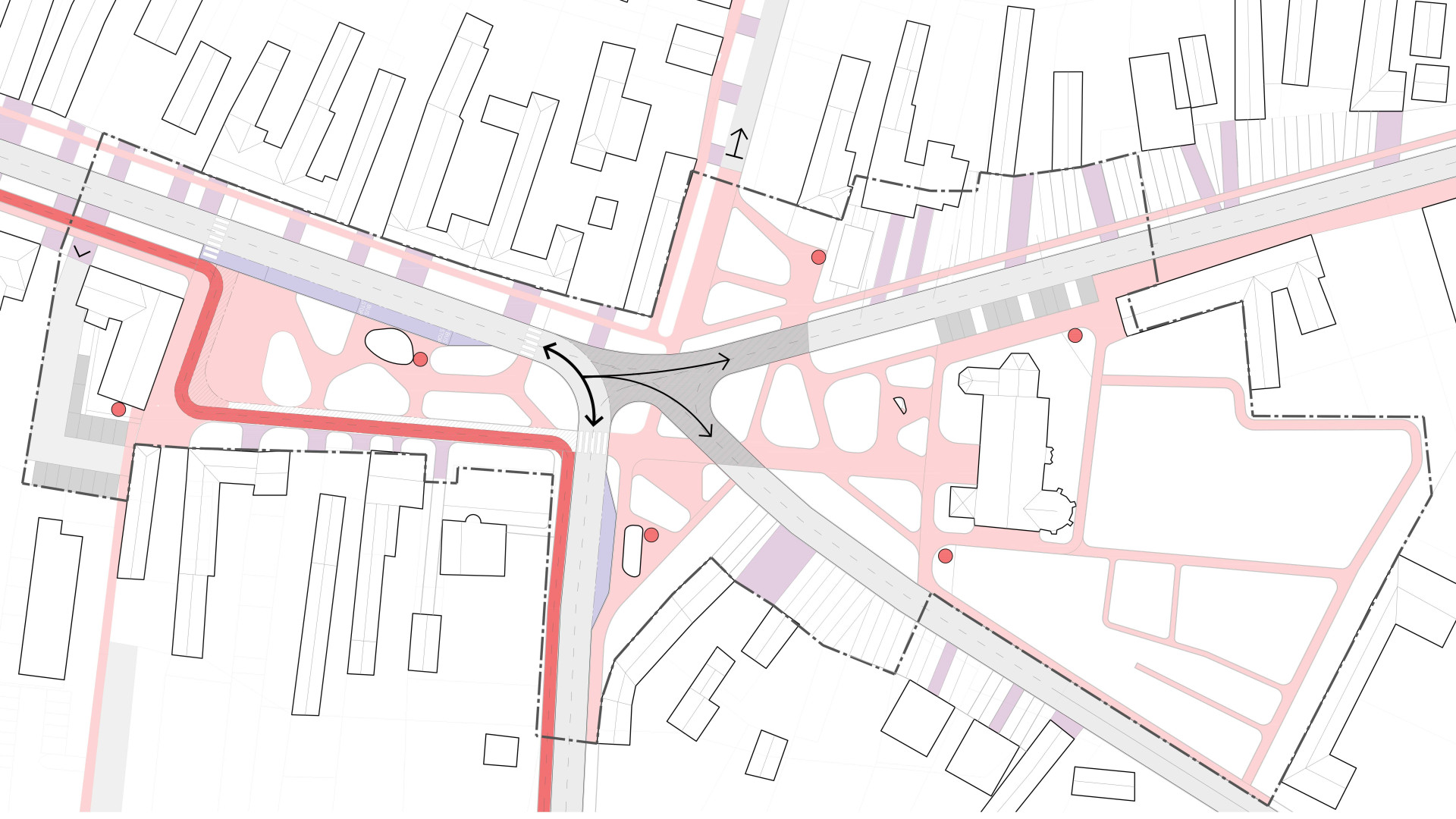
Diagram - Transportation
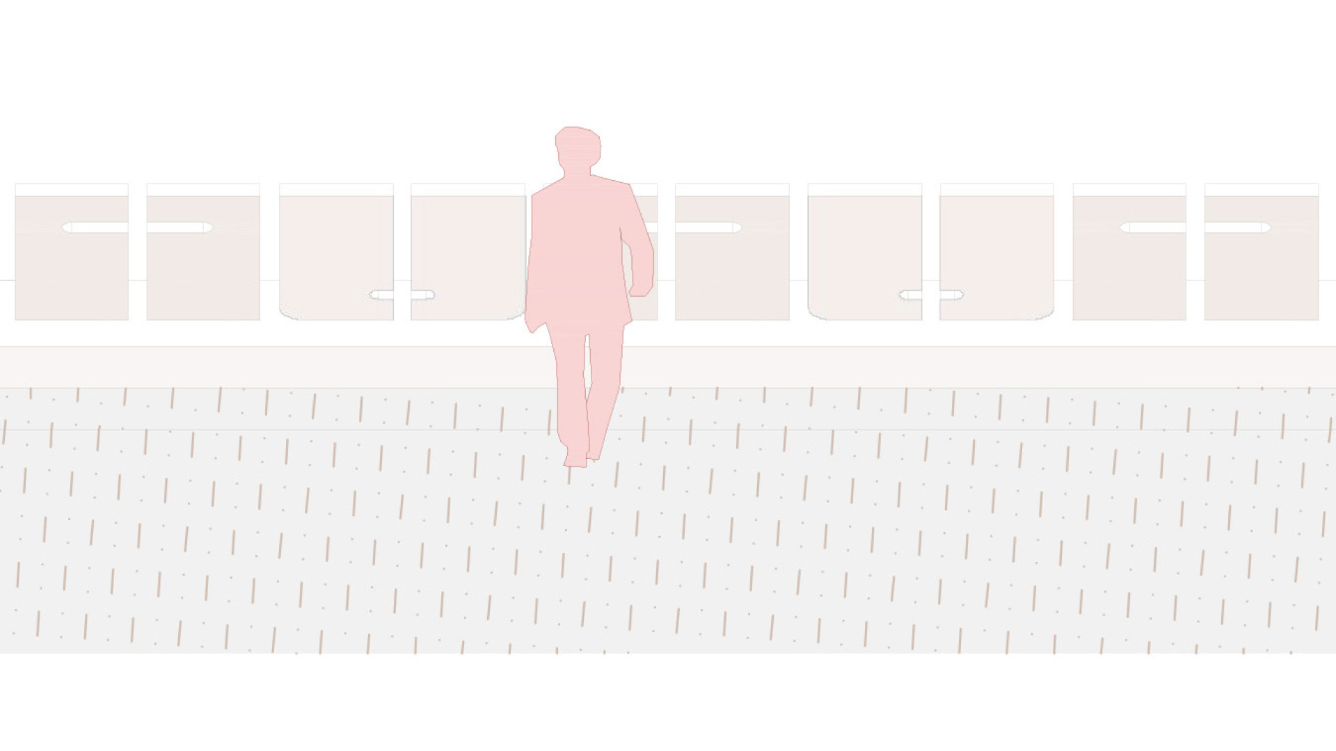
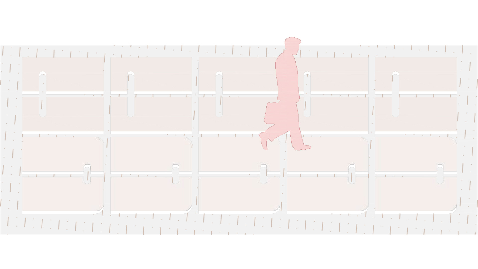
The original five-road intersection is transformed into a conventional four-road intersection, while Milan Urbana Street is closed as a cul-de-sac intended only for servicing residential houses. At the same time, it is maintained as a transverse axis leading toward the village subcentre of services. For buses, a bay is created on the main square with sufficient length to also function as a terminal stop, while a second bay with a bus stop is located near the memorial, connected to the axis of the rural promenade and the transverse axis leading toward the subcentre. Cycling infrastructure is designed along the main road, with a separated pedestrian path within the square. Bicycle stands are provided near the bus stops within a B+R (Bike and Ride) concept. For pedestrians, a hierarchy of pathways is established, ranging from the rural promenade to stepping-stone paths. Standard pedestrian crossings are proposed on the main road, while side roads use shared crossing zones with visual signalling through an ITS system. Static parking for the municipal office is relocated to its courtyard, and parking for the church is proposed next to the house of mourning.
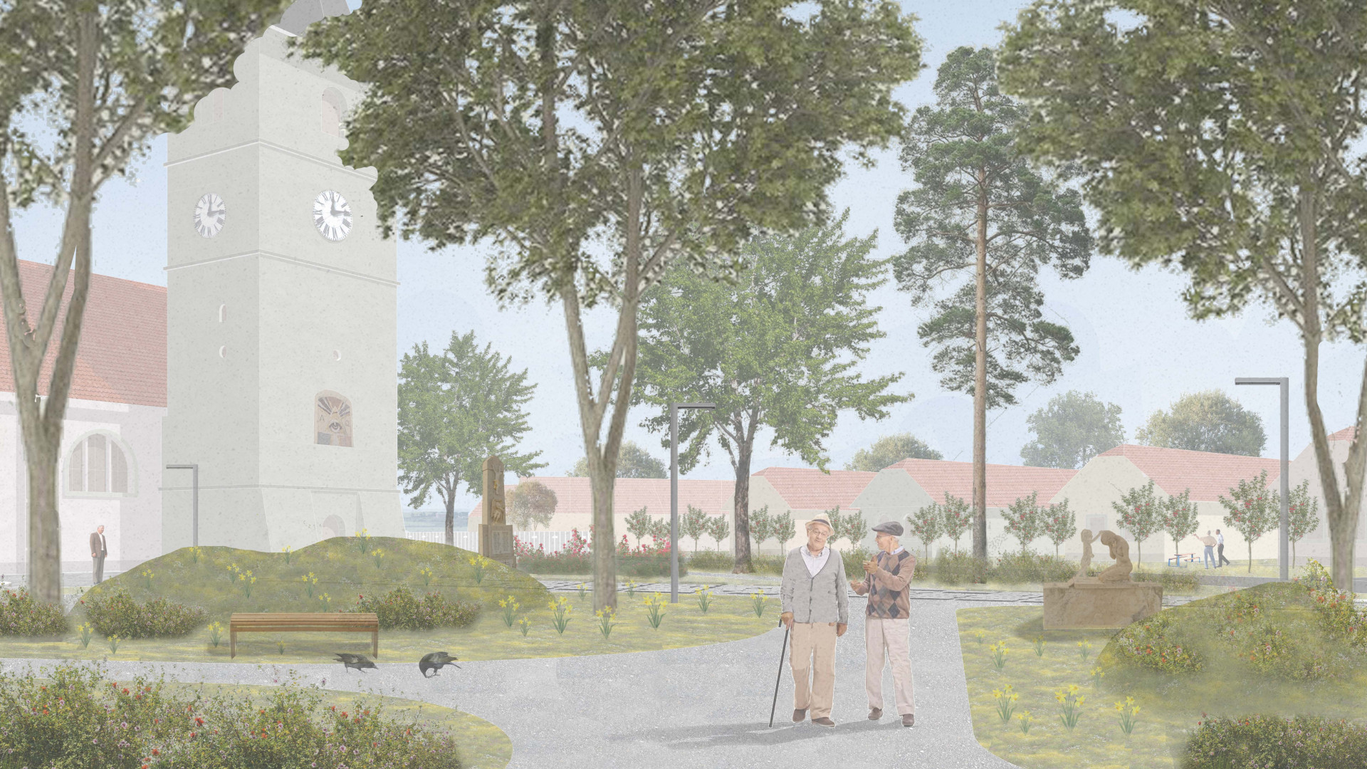
The park behind the church
Masterplan
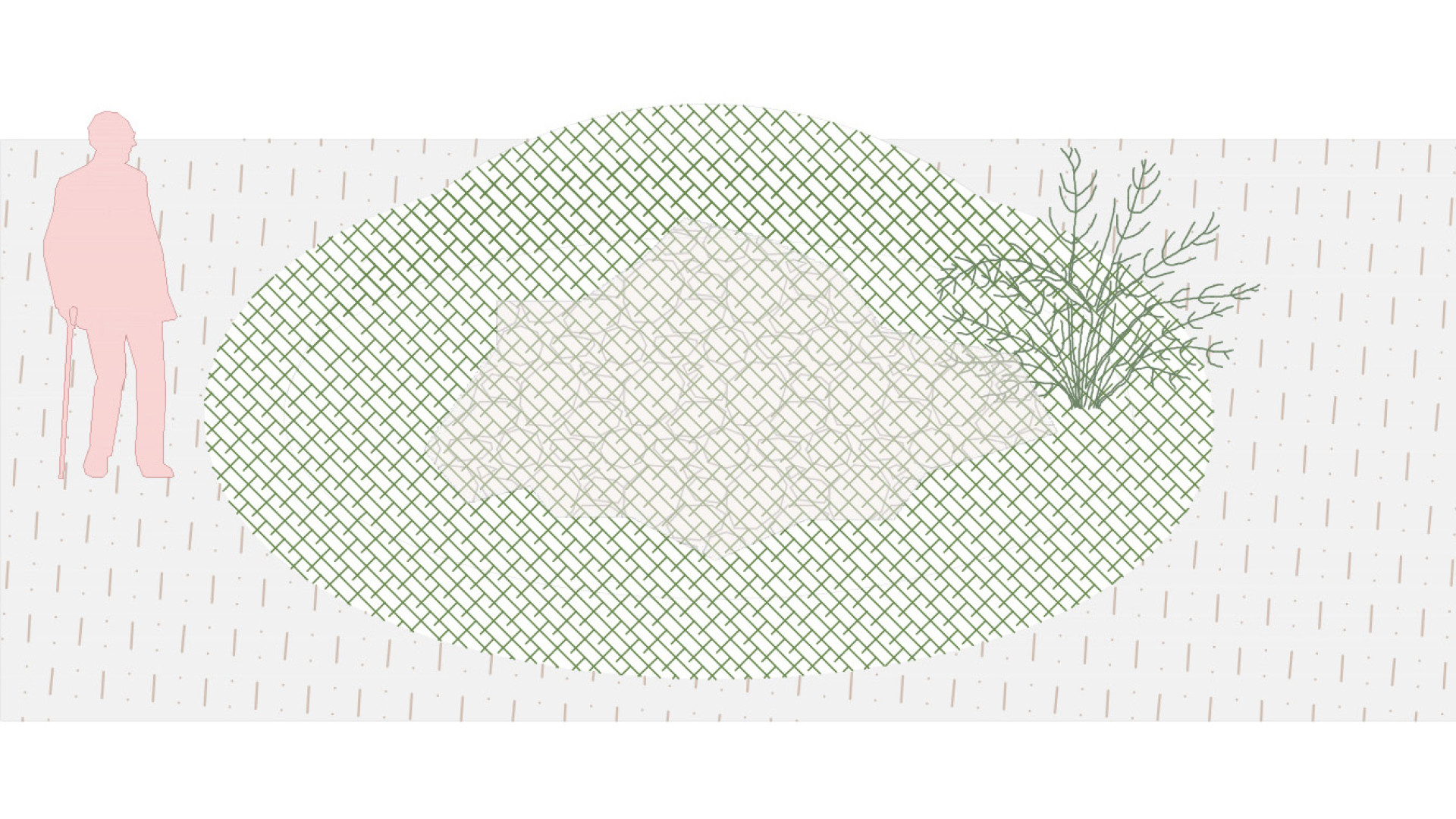
Reused for landscaping in the park
The reused fence is used for landscaping in the park and helps maintain material continuity.
Existing fence
Reusing the existing fence promotes material continuity, conserves resources, and reinforces the identity of the space in question.
Reused for the park's sidewalks
Recycled material from the fence is used for the park’s walkways and paved areas.
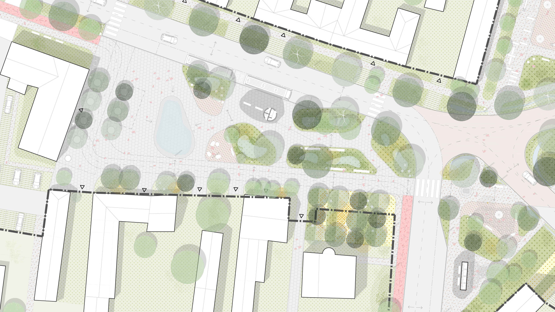
Square masterplan
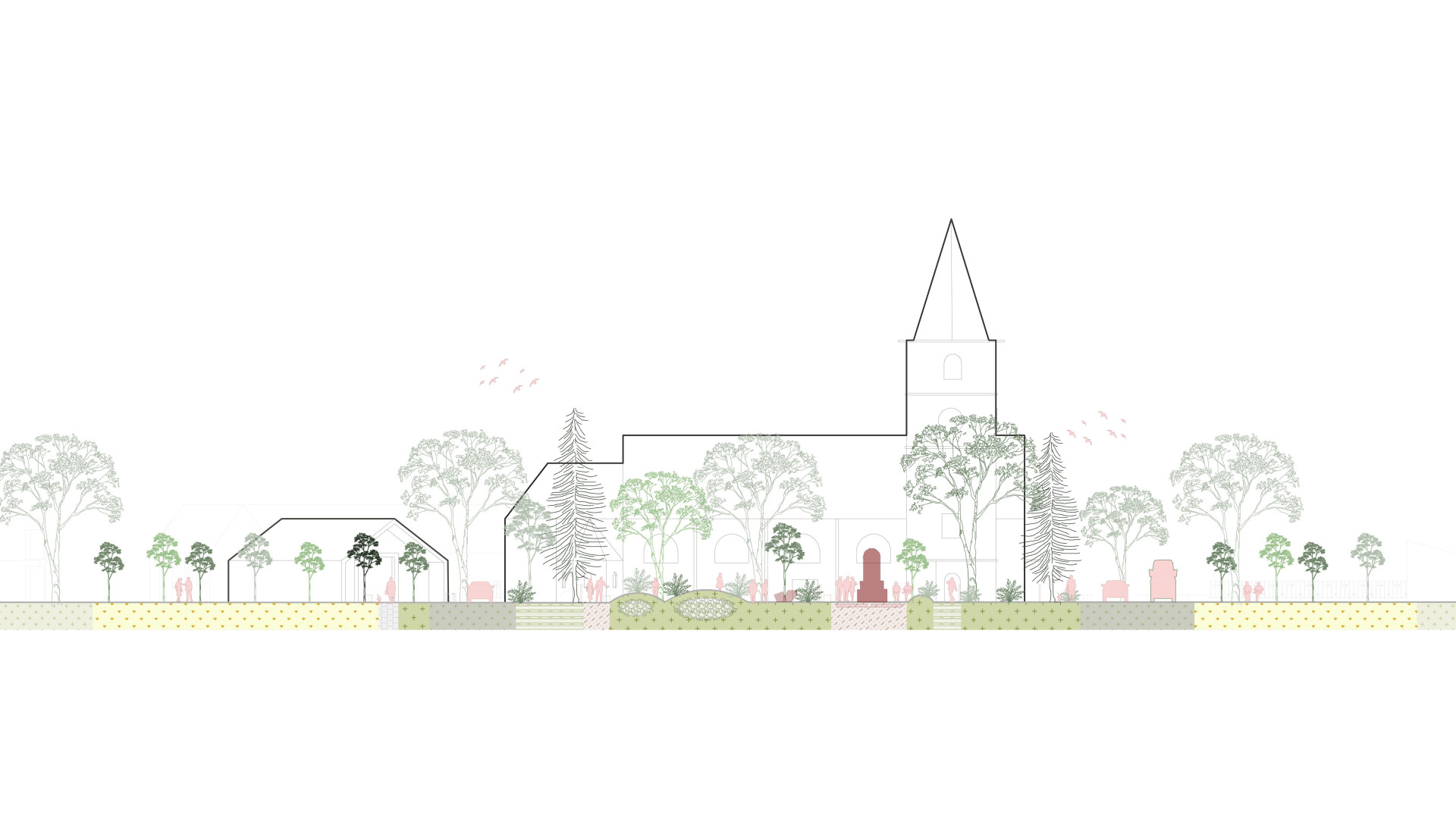
Section
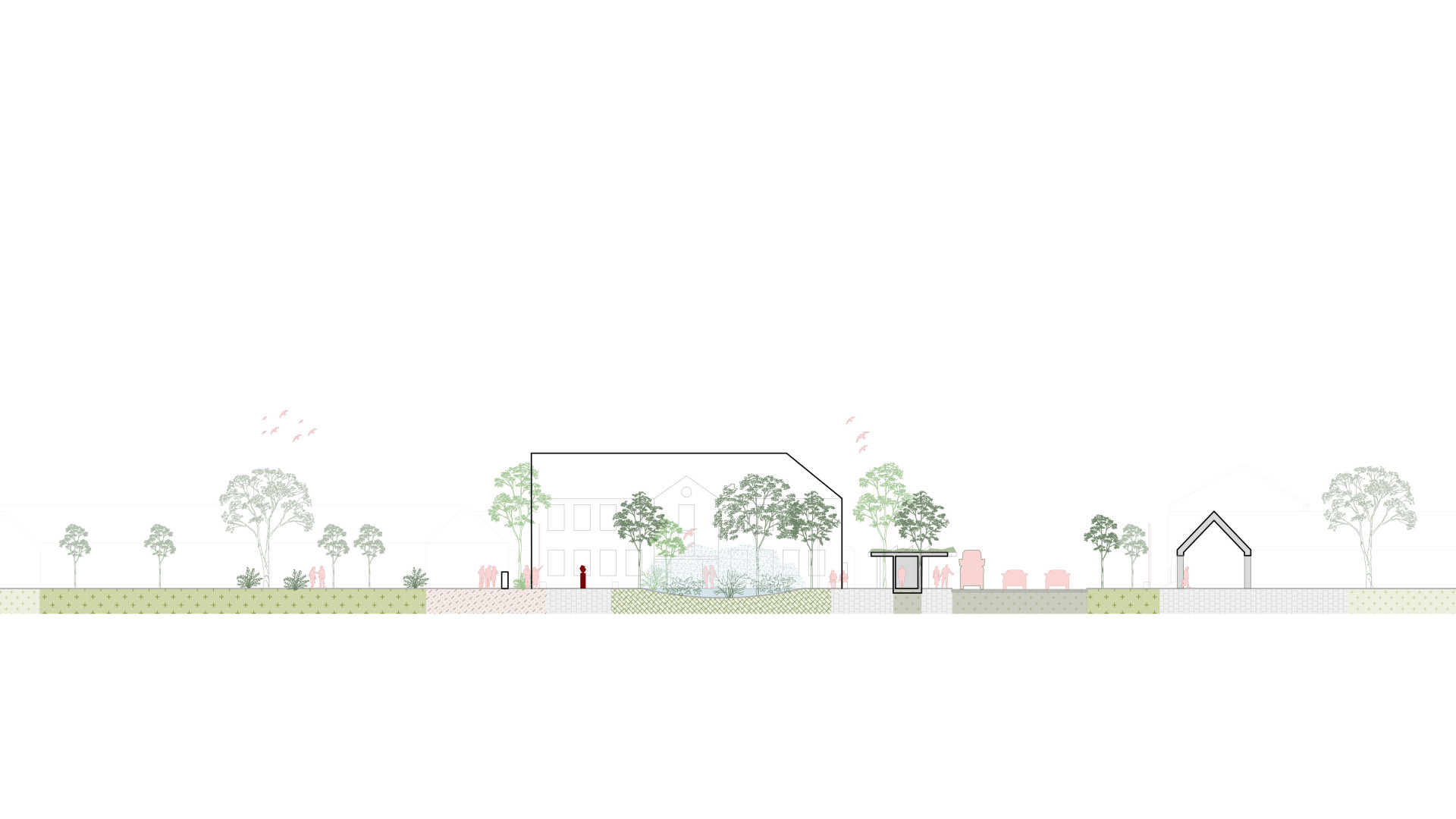
Section